Hiking in the Judean Wilderness Photo Credit: Josiah Chin-A-Young
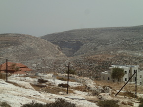
 Beth-Horon Ridge
 We're finally exploring the rest of the land of Israel!
It seemed like we were stuck in Jerusalem for an eternity (which is not necessarily a bad thing) until today: our Benjamin field study. After pointing out Kiriat Je'arim on the hill opposite Yad HaShmonah and discussing the tribal allotments of Israel, we hopped on the bus and headed for the tribe of Benjamin. Ironically, we started out our day by stopping within the confines of Dan. At any rate, we stopped at one of nine proposed sites for Emmaus: Emmaus Necapolis. While the site does have a lot of tradition behind it, it's not the correct spot. Benj and Bill believe that the real location of Emmaus lies within Abu Ghosh, the Arab town close to Yad HaShmonah. Luke 24:13 provides geographical details for the location of Emmaus.
Our next stop was the site of many great retreats in Israel's military history: the Beth-Horon Ridge Route. Surprisingly, it was behind a sketchy looking gas station. We hiked up the service road and looked out at the beautiful mountains before us. I even spotted some sheep on the closest hill. Beth-Horon is one of the main approaches to Jerusalem, and is also the northern boundary of the tribal allotment of Benjamin (Joshua 18:12). Like I mentioned before, many battles and retreats took place in this area, including Joshua's famous battle against the Amorites where the sun stood still. Having tricked Joshua into making a treaty with them, the Gibeonites called upon Israel for help defeating the attacking Amorites. Joshua, keeping his promise, hiked all night long from Gilgal. Attacking the Amorites that morning by surprise, Joshua prayed to the Lord that the sun and moon would stand still. Miraculously, God stopped the sun in its tracks, while the moon stood still over the Aijalon Valley. Victorious over the Amorites because of God's gracious miracle, Joshua routed his enemies down the Beth-Horon Ridge Route. God performed yet another miracle and sent huge hailstones with pinpoint accuracy to strike down the Amorites as they fled along the ridge (Joshua 10). The Philistines used this route three different times (1 Samuel 7:5ff; 14:31ff, 2 Samuel 5:17ff).
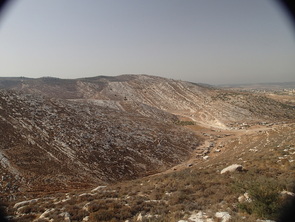
Speaking of Samuel, our next stop was where tradition says Samuel was buried. As always, the Crusaders were incorrect about the location, but it serves as a nice viewpoint for the main cities in Benjamin. The memorial was called Nebi (Hebrew: Navi - "prophet") Samwil (Samuel). You could see the three towers on the Mount of Olives from our first vantage point. Our second viewpoint was just behind Tel Gibeon, with the Sorek Valley in view as well. The modern Arab town of Ramallah swallows up biblical Ramah; Samuel's hometown. Judges 19:11 gives us clear indication where Ramah actually lies. So does Nebi Samwil have any significance? It's probably the site of the high place at Gibeon, detailed in 2 Chronicles 1. We also had a clear view of the ancient Road of the Patriarchs. The modern road still follows the same path.
It seemed like we were stuck in Jerusalem for an eternity (which is not necessarily a bad thing) until today: our Benjamin field study. After pointing out Kiriat Je'arim on the hill opposite Yad HaShmonah and discussing the tribal allotments of Israel, we hopped on the bus and headed for the tribe of Benjamin. Ironically, we started out our day by stopping within the confines of Dan. At any rate, we stopped at one of nine proposed sites for Emmaus: Emmaus Necapolis. While the site does have a lot of tradition behind it, it's not the correct spot. Benj and Bill believe that the real location of Emmaus lies within Abu Ghosh, the Arab town close to Yad HaShmonah. Luke 24:13 provides geographical details for the location of Emmaus.
Our next stop was the site of many great retreats in Israel's military history: the Beth-Horon Ridge Route. Surprisingly, it was behind a sketchy looking gas station. We hiked up the service road and looked out at the beautiful mountains before us. I even spotted some sheep on the closest hill. Beth-Horon is one of the main approaches to Jerusalem, and is also the northern boundary of the tribal allotment of Benjamin (Joshua 18:12). Like I mentioned before, many battles and retreats took place in this area, including Joshua's famous battle against the Amorites where the sun stood still. Having tricked Joshua into making a treaty with them, the Gibeonites called upon Israel for help defeating the attacking Amorites. Joshua, keeping his promise, hiked all night long from Gilgal. Attacking the Amorites that morning by surprise, Joshua prayed to the Lord that the sun and moon would stand still. Miraculously, God stopped the sun in its tracks, while the moon stood still over the Aijalon Valley. Victorious over the Amorites because of God's gracious miracle, Joshua routed his enemies down the Beth-Horon Ridge Route. God performed yet another miracle and sent huge hailstones with pinpoint accuracy to strike down the Amorites as they fled along the ridge (Joshua 10). The Philistines used this route three different times (1 Samuel 7:5ff; 14:31ff, 2 Samuel 5:17ff).
Speaking of Samuel, our next stop was where tradition says Samuel was buried. As always, the Crusaders were incorrect about the location, but it serves as a nice viewpoint for the main cities in Benjamin. The memorial was called Nebi (Hebrew: Navi - "prophet") Samwil (Samuel). You could see the three towers on the Mount of Olives from our first vantage point. Our second viewpoint was just behind Tel Gibeon, with the Sorek Valley in view as well. The modern Arab town of Ramallah swallows up biblical Ramah; Samuel's hometown. Judges 19:11 gives us clear indication where Ramah actually lies. So does Nebi Samwil have any significance? It's probably the site of the high place at Gibeon, detailed in 2 Chronicles 1. We also had a clear view of the ancient Road of the Patriarchs. The modern road still follows the same path.
Tel Gibeon viewed from Nebi Samwil
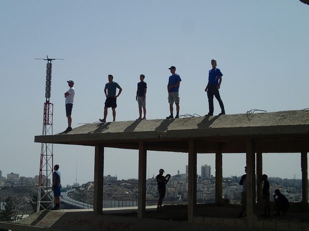
(left to right) Wes, James, Isaiah, Josh, and David on the unfinished palace at Gibeah
 The cliffs near Michmash that Jonathan and his armor bearer climbed (1 Samuel 14)
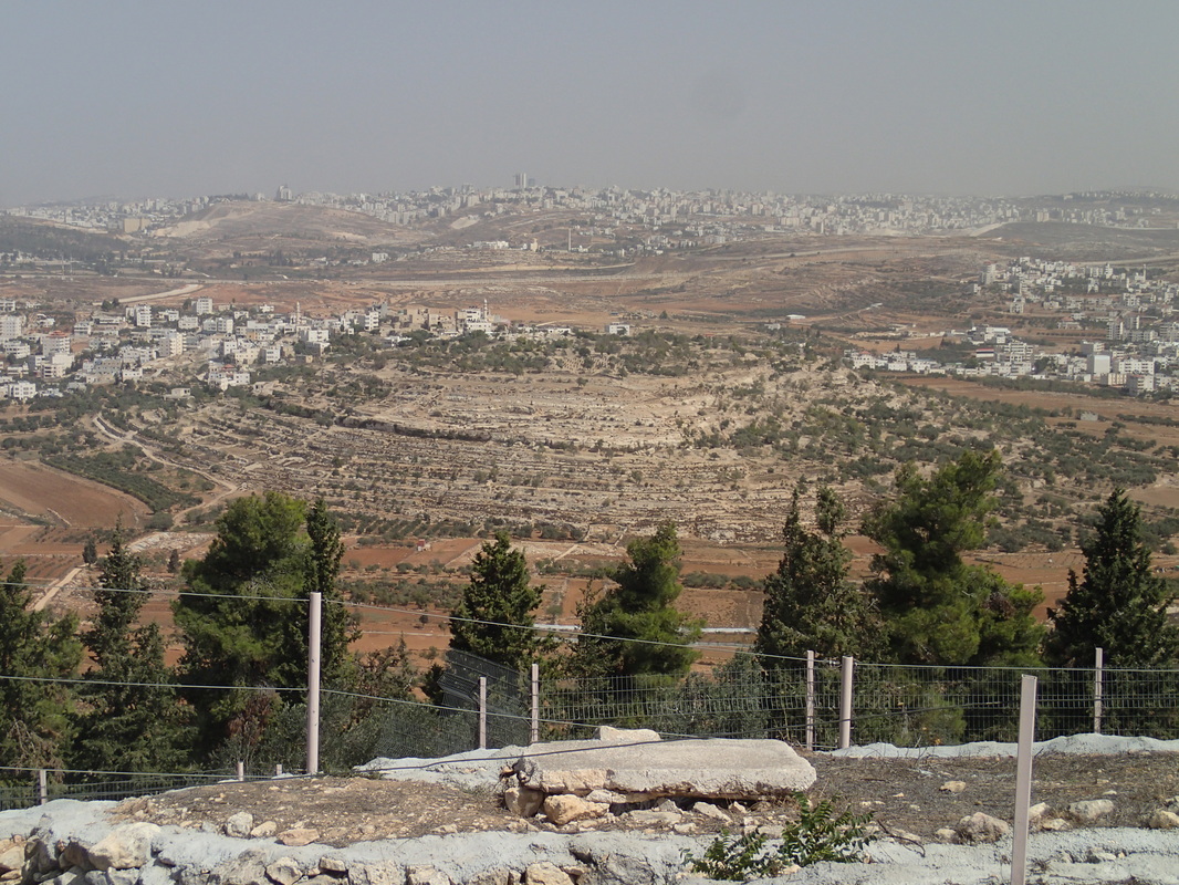
 Moving on from there, we stopped at Gibeah. We were sitting in what was supposed to be the king of Jordan's palace. Construction was never finished, due to the Six Day War breaking out. Now, it looks like an old abandoned parking garage, covered in graffiti. This was likely the place where Saul's palace was built. To the east was Nahal Parat, where Jeremiah was told to hide his belt in Jeremiah 13. Nahal Parat and the Sorek Valley force all traffic through Gibeah. In Judges 19, we find the story of the Levite and his concubine and the men of Gibeah. Not a very pleasant story, but it goes to show how depraved the time of the Judges became, as Judges 21:25 so aptly summarizes. We also discussed the importance of Mizpah, and how it was the capital of the district in Jeremiah 40:9.
And now for my second favorite site of the day: The Pass. Once again, the modern road still follows the ancient road. We faced Geba to the south, which marks the eastern rim of the Central Benjamin Plateau. Michmash was behind us, and the Wadi Suwenit was just in front of us in the valley. 1 Samuel 13:3ff details an awesome battle against the Philistines that took place in the area we were sitting in. Jonathan and his armor bearer climbed up two crags (just to our left) to get to the Philistine camp (1 Samuel 14). As per usual, Jonathan chases the fleeing Philistines down the Beth-Horon Ridge Route. We also read Isaiah 10, where Isaiah describes the approach of the Assyrians. The geographic details are so precise that you have to conclude that this took place in a real spot. Isaiah knew the land exactly. We all stopped at a well on the top of the hill to get some refreshing cold water dumped on our heads before heading to Jericho.
Jericho: an archaeological controversy combined with a random tropical paradise in the middle of nowhere desert. Many excavators have come and placed their mark on the tel, but Kathleen Kenyon is the most notable, since she truly started the controversy surrounding Jericho. She dated the city walls found at Jericho to 1550 BC, which seems innocent until you realize that Joshua's conquest was in 1406 BC. Other archaeologists, like Garstang, dated the walls to around 1400 BC, matching with the biblical account. I won't take the time to explain and resolve the controversy here, mostly because that would be a fifty page paper in and of itself. One of the more notable evidences of God's hand at Jericho is what direction the walls fell. According to the archaeology reports, the walls of the city fell outward, towards the attackers. Why is that significant you ask? If you're trying to push down city walls from the outside, they would fall away from you, into the city. But Jericho's walls fell away from the city and towards the attacking Israelites. Enter God's miracle (Joshua 6).
After stopping at the most beautiful sycamore tree I've ever seen in my life (Luke 19; Amos 7:14), we stopped at New Testament Jericho. In Jesus' time, Jericho extended farther than the original city bounds. Built by Herod the Great, Jericho extended all the way up near the Wadi Qilt. Herod also drowned his wife Meriamne's brother in this spot.
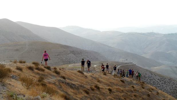
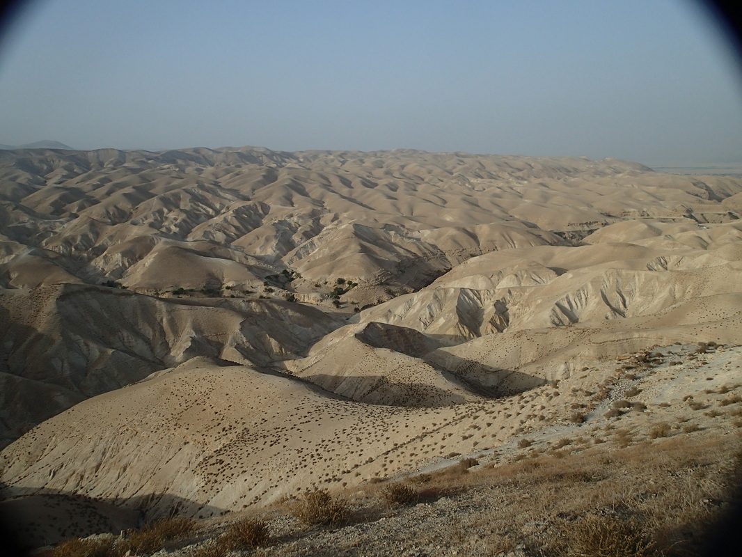
Finally, we stopped in the Judean Wilderness; my favorite spot in Israel thus far. Bedouin tents dotted the rolling bare hills. This is where Jesus was tempted; where He wandered for forty days without food. This is where John the Baptist lived before he appeared in the New Testament (John 1:19ff). This is where Isaiah prophesies about the forerunner of the Messiah (40:3ff). In the spring time, the barren hills that stood before us will be covered in a green, lush carpet. Once we got back home, several of us googled what the Judean Wilderness looked like in the spring and couldn't believe our eyes. It really drives home how dependent Israel was (and still is) on God for rain every year. Out of all the other sites, this last stop was definitely the most impactful for me.
Finally, we stopped in the Judean Wilderness; my favorite spot in Israel thus far. Bedouin tents dotted the rolling bare hills. This is where Jesus was tempted; where He wandered for forty days without food. This is where John the Baptist lived before he appeared in the New Testament (John 1:19ff). This is where Isaiah prophesies about the forerunner of the Messiah (40:3ff). In the spring time, the barren hills that stood before us will be covered in a green, lush carpet. Once we got back home, several of us googled what the Judean Wilderness looked like in the spring and couldn't believe our eyes. It really drives home how dependent Israel was (and still is) on God for rain every year. Out of all the other sites, this last stop was definitely the most impactful for me.
 RSS Feed
